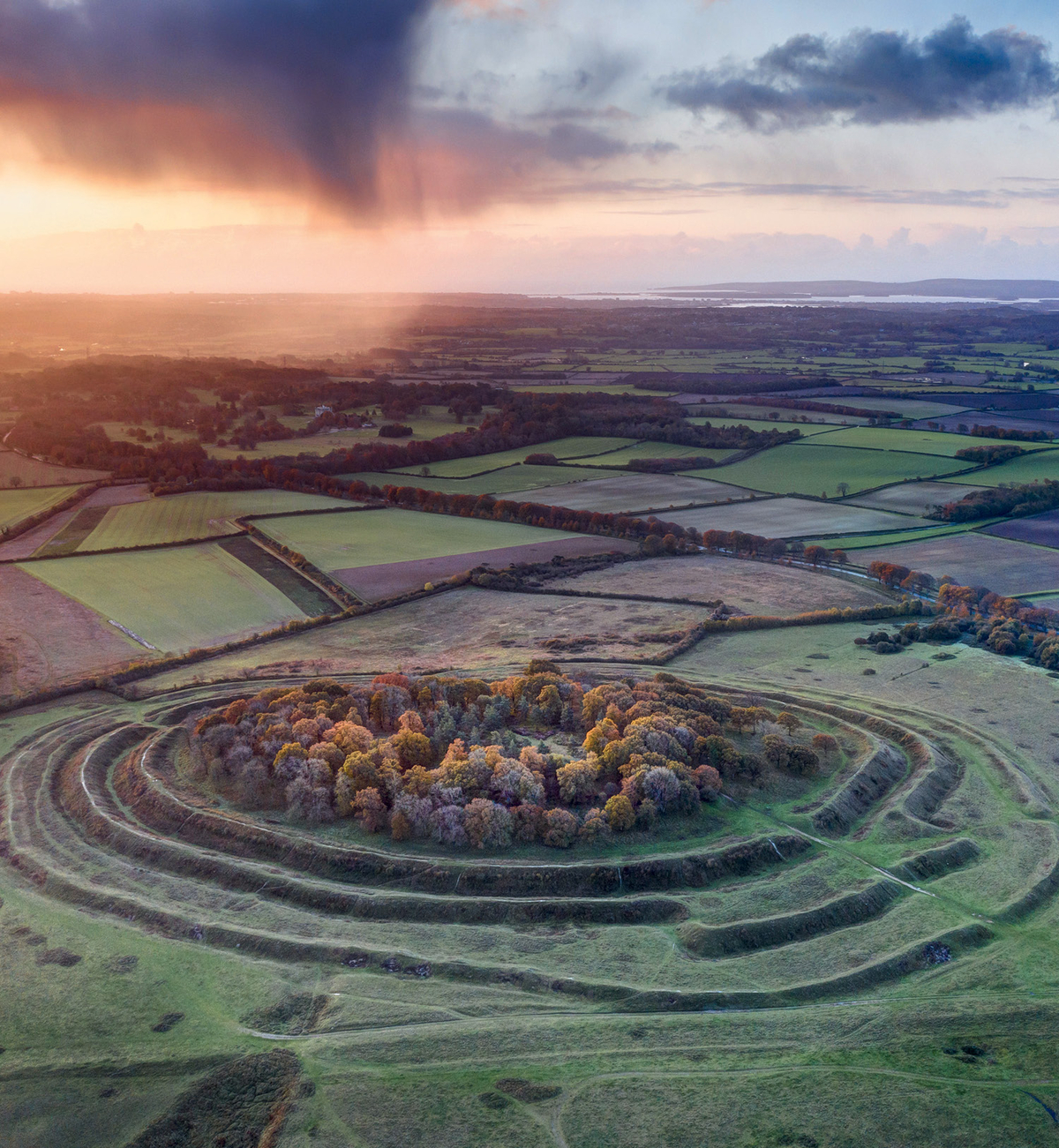
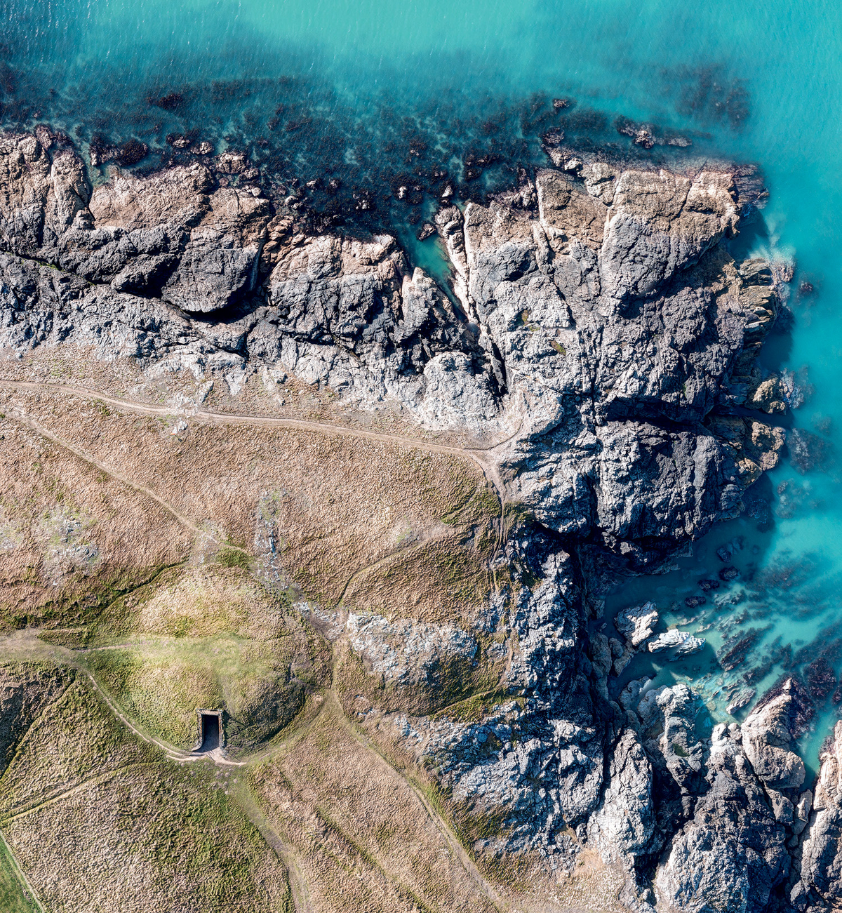
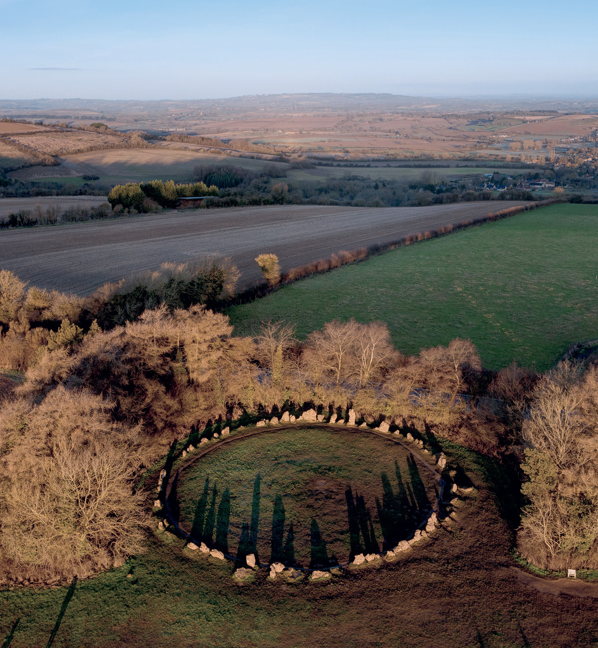
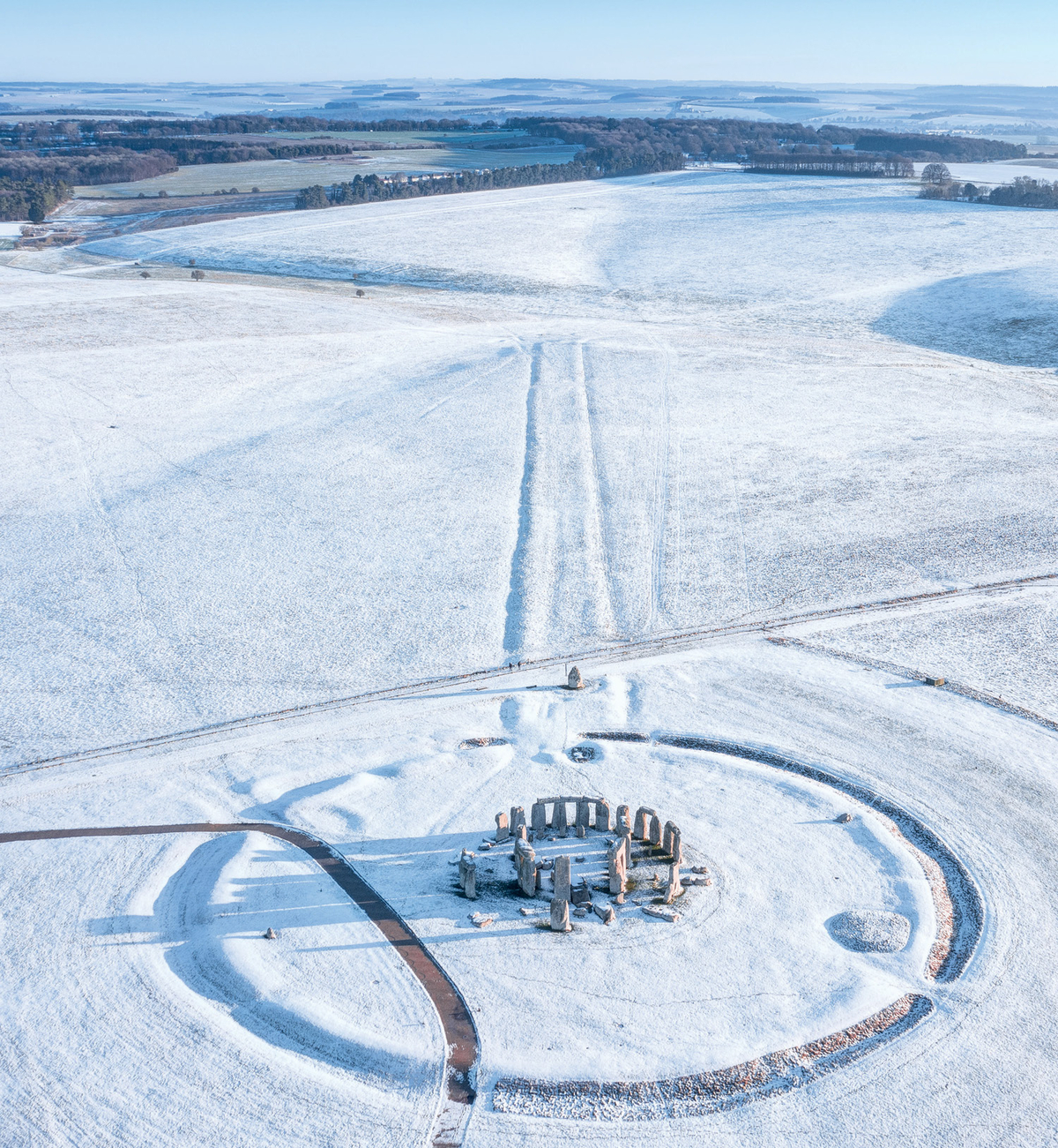
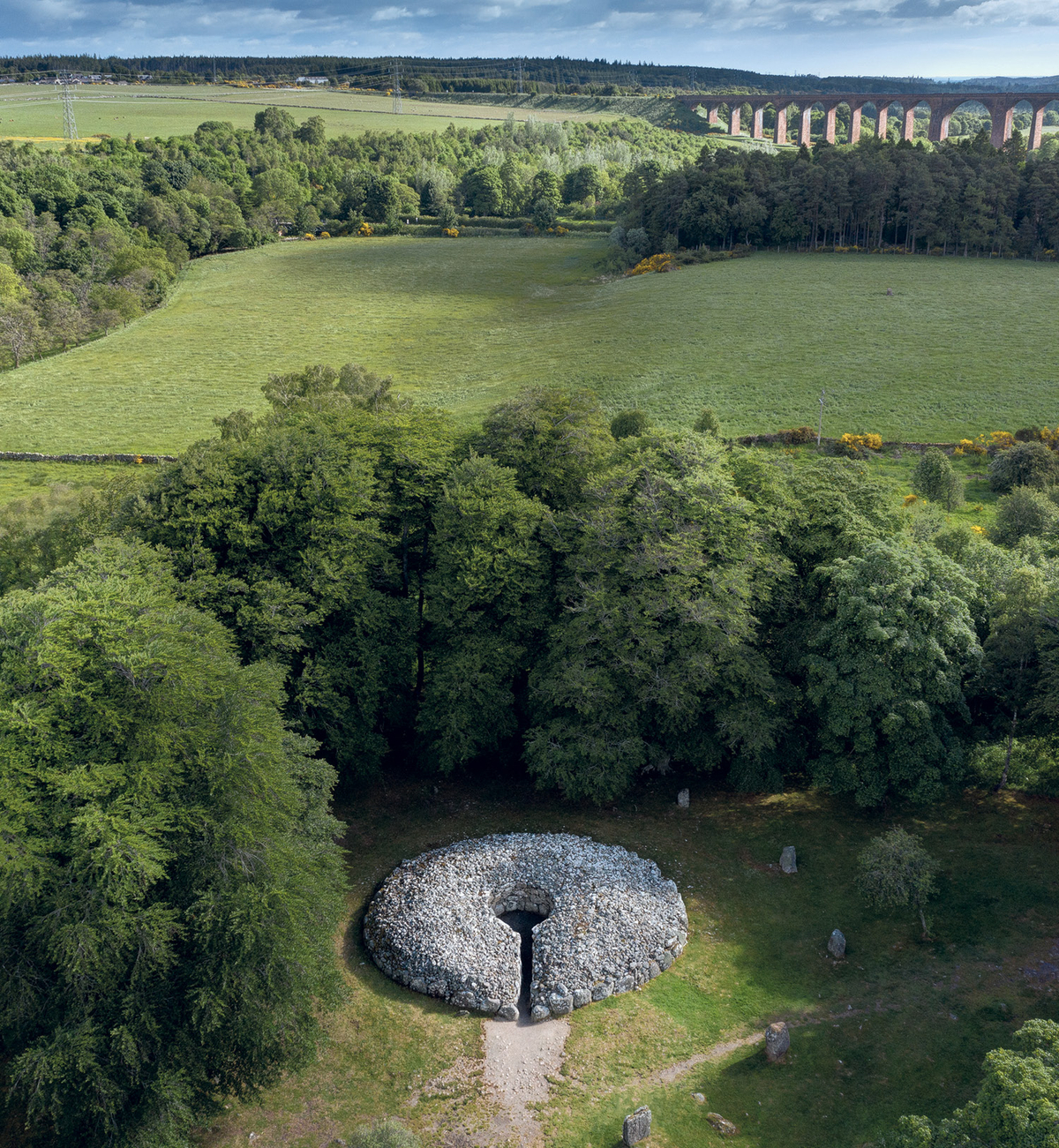
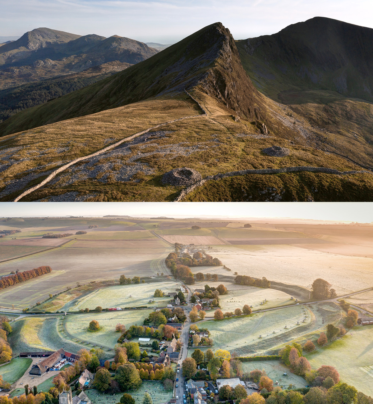
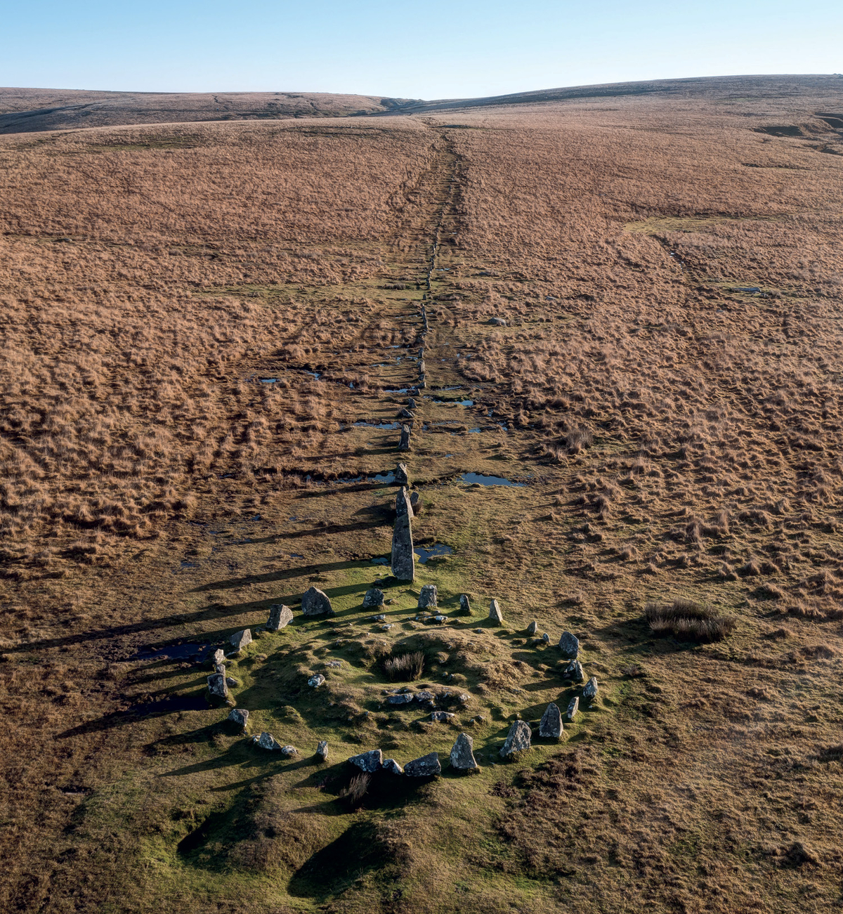
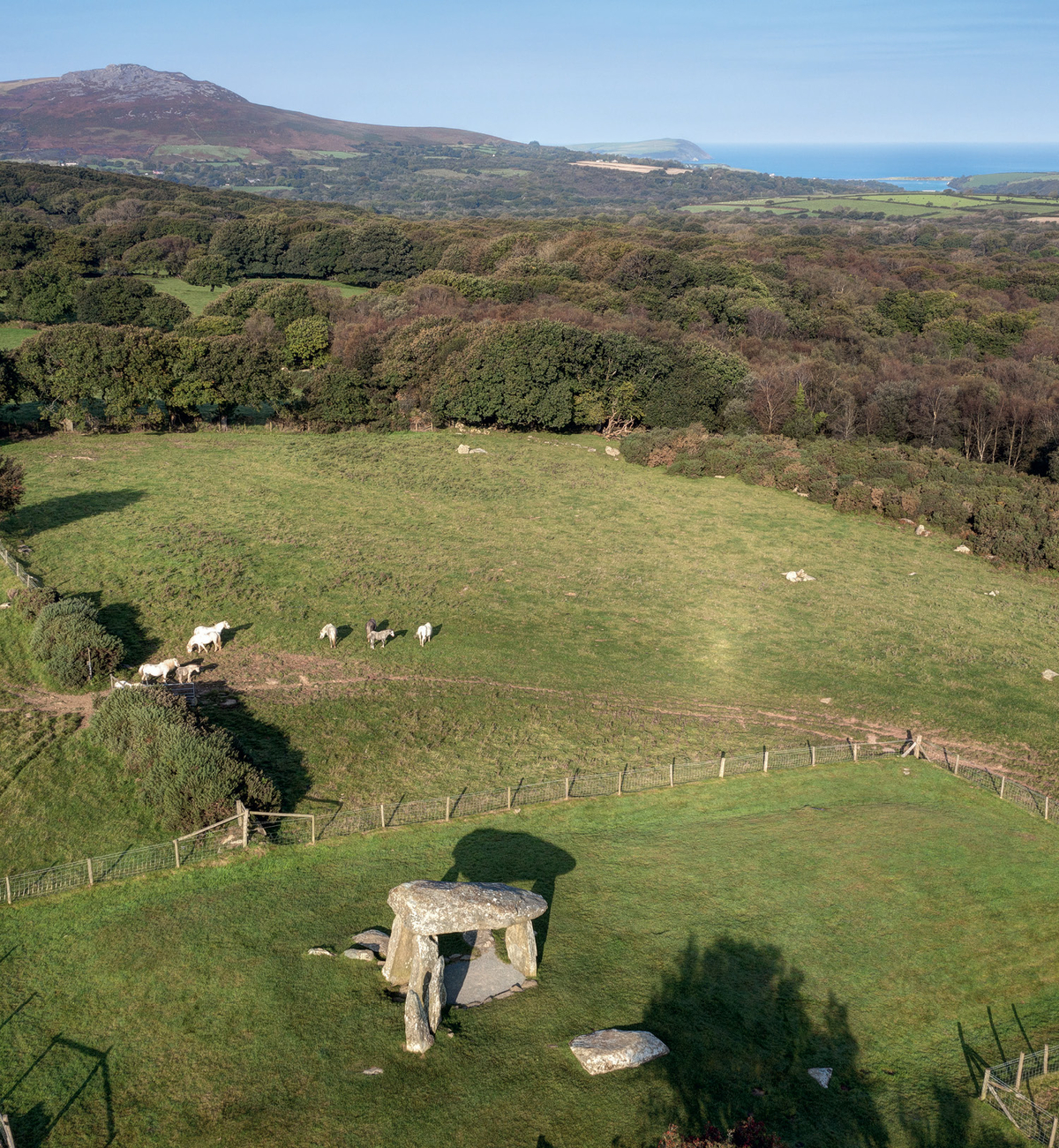
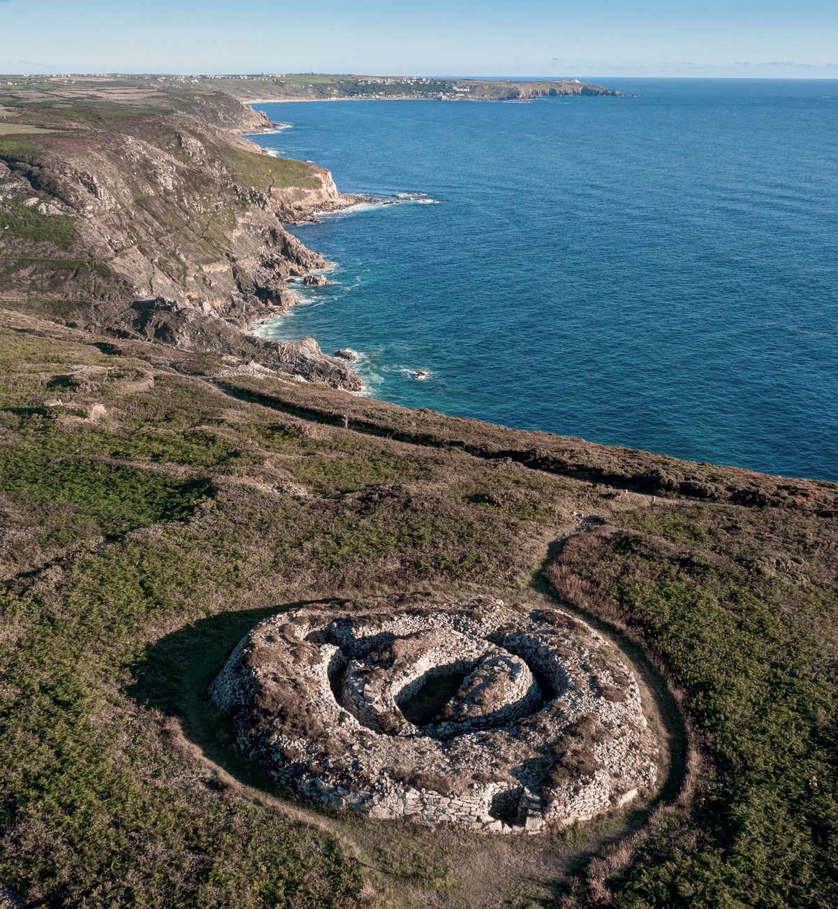
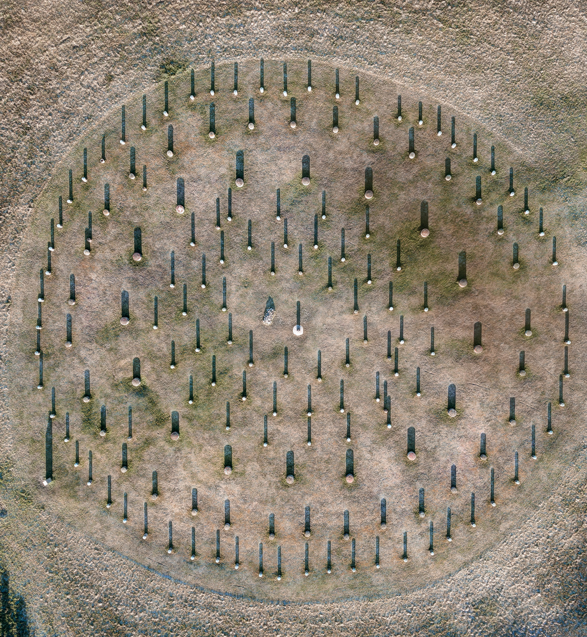
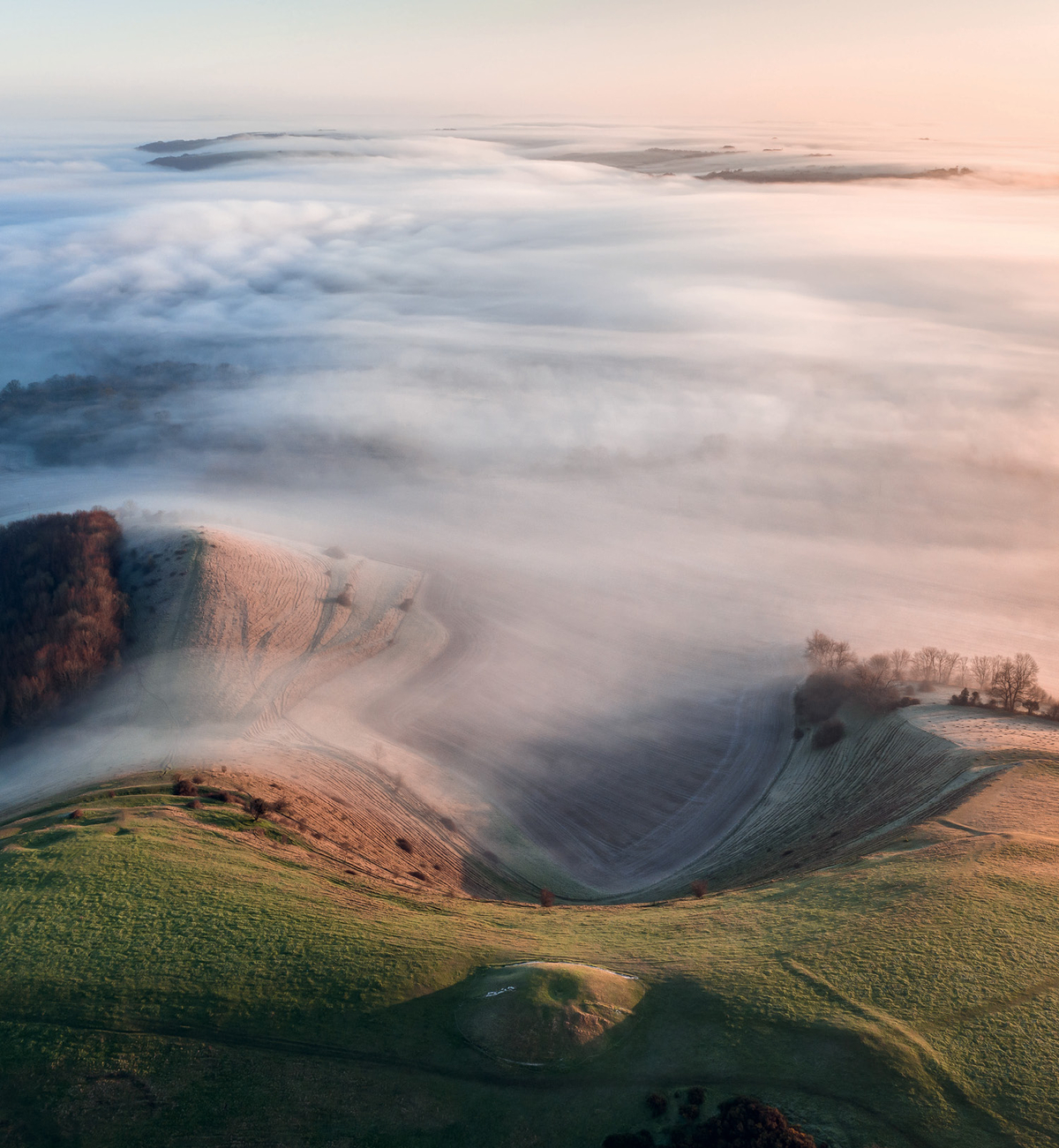
The writer and artist David R. Abram is Welsh but now lives in the English countryside, on the border between Somerset and Wiltshire. Stonehenge is only a few miles away, as are the Iron Age hill forts of White Sheet Hill and Winklebury Camp. Over the last several years, using drones and telescopic poles to take photographs from above, Abram has created composite pictures of these ancient sites.
The aerial images often reveal topographical secrets. “What may appear as clusters of random lumps, bumps, and banks at ground level,” he has said, “often resolve into striking forms when viewed from the air.”
Viewed in Abram’s studio, in Frome, Somerset, these photographs, which are often taken at either dawn or dusk, might read like paintings. They are “painterly in tone and tending towards abstraction.”
Four years ago, Abram started traveling across the country, on a mission to capture aerial shots that could be compiled into a single encyclopedia. His book, Aerial Atlas of Ancient Britain, out now, presents 227 color photographs, starting with the early hominin treasures of the deep Paleolithic, and finishing with the abandoned fortifications of the Iron Age (dating back to the Roman invasion, in 43 A.D.). In these glossy pages we learn of stone tools 866,000 years old and Iron Age roundhouses with conical thatched roofs. Abram shot many of the pictures during the pandemic, when Britain’s empty highways, pastures, and cliffsides were at their most majestic. —Elena Clavarino

Elena Clavarino is the Senior Editor for AIR MAIL